
24 Jan 2013: We took a flight to San Juan, Puerto Rico and picked up a rental car to drive to the Aricebo area on the north coast of this Connecticut-sized island. It is 100 miles across and 50 miles wide, and after a month here we expect to have covered a lot of ground, or be 6' under the ground having not survived the traffic.

The car on the right has a red light but is looking to go anyway.

Arecibo, the coastal town of where we are staying.
We are about 5 minutes inland in the rural Barrio of Pajuil.

Thom is back in training for a marathon; here he is at the local track, the crowd cheering him on.

Our neighbor. I hope he will eat all the mosquitos that are eating me.

26 Jan 2013: Thom getting his hair styled at the local salon, Arecebo Observatory.
You may recognize it from the movies Contact and Golden Eye.

They say the dirt, moss, mold and etc., doesn't effect the satellite's effectiveness.

28 Jan 2013: The Museo Indigena Cemi.
Puerto Rico has four main cultures: Indian, Spanish, African and American.

Salto de Dona Juana, in the mountains close to the middle of the island. They say it's not the destination, it's the journey; and so it was with this trip. Many very windy windy windy narrow roads. Once there, it was too much to face the journey back; we travelled to the south coast to Ponce and picked up a straighter road to take back to the north coast.

The beautiful scenery in the mountains was well worth the time and effort.

29 Jan 2013: Arecibo has a lighthouse...

...and this why!

Thom at Playa Sardinera

30 Jan 2013: Thom at a popular icecream shop,
responsible for double parking in the tiny streets of old town Lares.

They are famous for their maize (corn) icecream, but after a ceremonial spoonful
we opted for strawberry, vanilla, and chocolate. Not very adventurous tourists.

Thom in the town square, Lares, Puerto Rico.

2 Feb 2013: Thom braved the traffic to take a picture of these two ceiba trees in the middle of divided highway 2 at km marker 99.4 east of Quebradillas. The ceiba tree is the national tree of Puerto Rico.

Our rental car for the month, a Toyota Yaris. Good thing we didn't bring much luggage.

Coastal view from km marker 103.6 on the 2. This is how you get around in Puerto Rico.
Our instructions to get to our host's home was go to km 2.8 on Rt 490.

Balneario Crash Boat Beach, on the west coast north of Aguadilla.

Playa Jobos on the north coast by Isabela.

Playa Jobos

Each town seems to have a welcome sign; this is a tile mosaic at Quebradillas.

Thom with Queen Isabela at the Museum of Art, Ponce
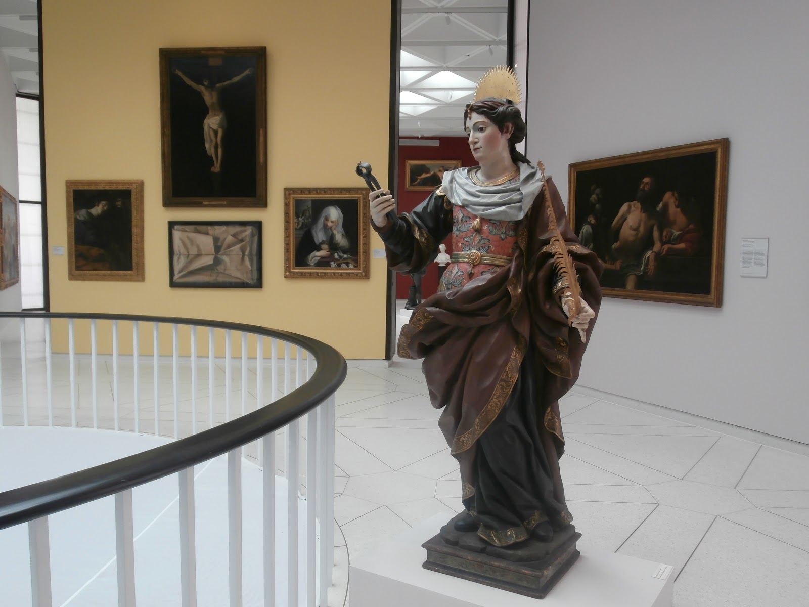
Well worth a visit, admission is $6 adults, $3 children and seniors.

The Marina at Ponce, Puerto Rico


A colorful village,Yauco, looking good from afar. Many Puerto Rican homes, walls or fences need a good powerwash and paint. The climate and ocean proximity is hard on the structures on the island.


The oldest church in Puerto Rico is in the quaint town of San German, which is also the only town in PR to have two town plazas.


Thom at a lovely beach just around the corner from the dangerous cliffs of Cabo Rojo.


The treacherous cliffs of Cabo Rojo. Since records have been kept, over 70 people have fallen down these cliffs. Only one survived, and we met him in Arecibo. Elder Hammer, a missionary for the Church of Jesus Christ of Latter-day Saints, fell 50 feet after a mis-step at Cabo Rojo. He underwent three surgeries and physical therapy for three months before returning to finish a 2-year mission in the Caribbean. On the cliff edge, we saw a stone inscribed with a victim's name, date and the sentiment "Gone Home." We suggested one for Elder Hammer to read, "Went Home, Came Back."


...let them take the hit.

but apparently they are already on the books.
He calculates that for every ten miles he travels, he sees an average of nine cars with a headlight out.


Thom at the lighthouse in Rincon, on the NW coast.

Thom experimenting with his drawings, Balneario Rio Rincon.


This famous profile is on the Puerto Rican licence plate.

During WWII, artillary bunkers were also added to north side facing the Atlantic Ocean.


In a plaza, children enjoy getting cooled off on a hot day.

Does this mean that if there is no warning label we CAN drink the water?

Old San Juan, Puerto Rico

Old San Juan, Puerto Rico

The Botanical Gardens, just outside San Juan

We chose the days in San Juan to include Tony and Debbie's cruise ship stop.
Here, Debbie, Tony, Sheila and Thom eat a Puerto Rican dish "Mofongu" at the Cafe Puerto Rico, just off the NW corner of Plaza Colon, said to be the best place to order it.


The high winds stop Thom and I from making a trip to the island of Vieques;
12 foot swells for the rest of our time in the area.